
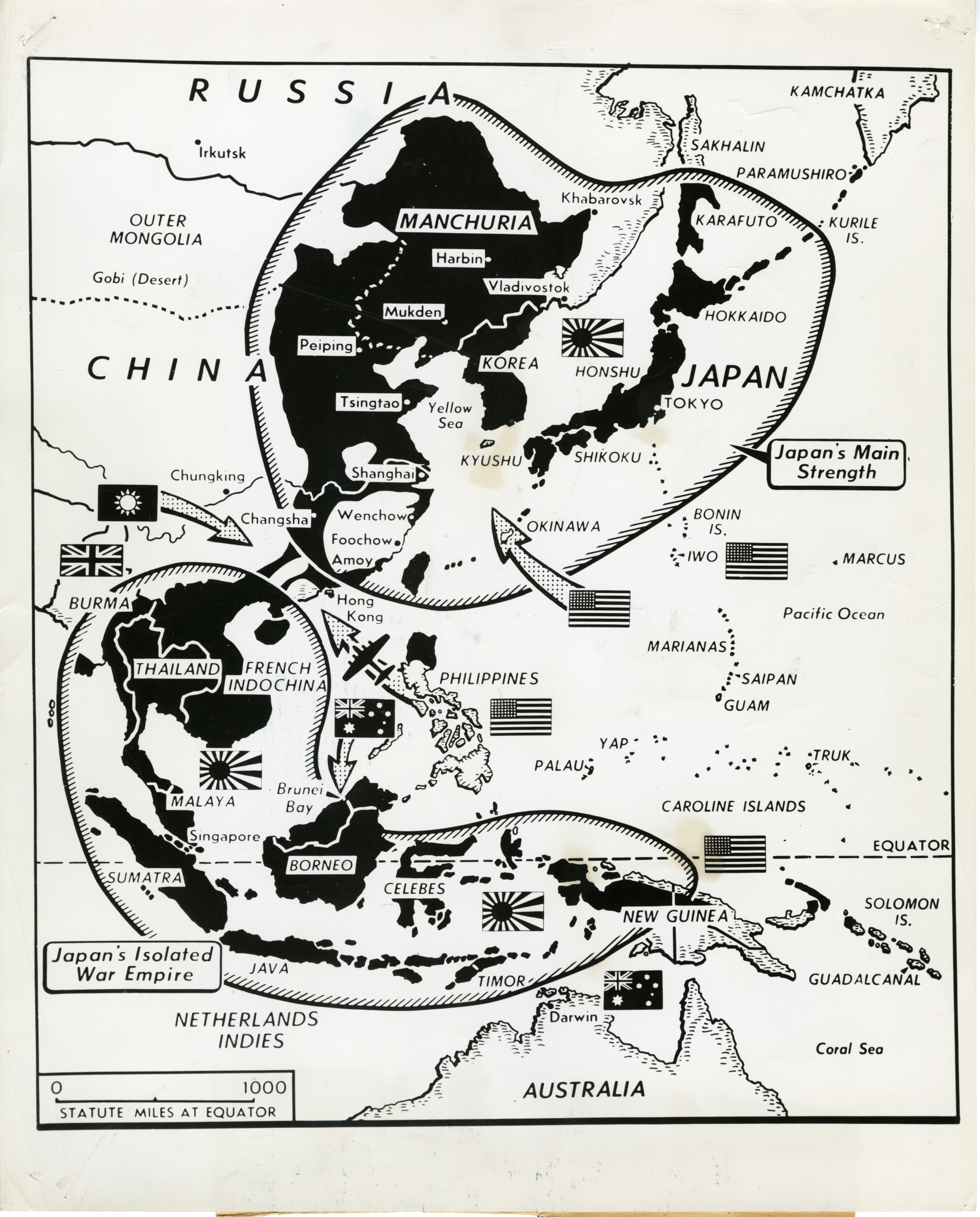
Map of Japanese holdings in western Pacific Theater, 1945
Description:
Photograph. Map of Japanese holdings in western Pacific Theater, split by the Allies. Official Caption: "Rome 8/8/45. Allied might splits Japanese holdings. This map illustrates how the Allies have virtually split the Japanese forces into areas. Allied land, sea and air blows (arrows) have isolated the enemy's war-gotten empire in southern Asia and the Indies from the Japanese home islands and northern China. Photo through U. S. I. S. Rome. ??265-PPA Approved by appropriate U.S. authority--Not for publication ( A and B lists out)." Pacific Theater. 8 August 1945
Image Information
Donor:
Accession Number:
Date:
08/08/1945
Hometown:
Branch:
Theater of Service:
POW / KIA:
Topical Subjects:
Collection Level:
Items from the service of Isaac "Ike" Bethel Utley, who was born in Smith Mills, Kentucky on 3 March 1920. Ike enlisted in the Army Air Corps on 19 January 1942. He was shipped overseas to the European Theatre and worked with a supply division based out of the city of Naples with an office set up in a residential villa. Utley worked with the Office of War Information and used their photographs in news articles to inform soldiers of the progress of the war. At war's end, Utley returned stateside. A trunk full of over 800 photographs from the O.W.I. arrived on his doorstep from his office in Italy, sender unknown. This collection consists of those photographs.
Thesaurus for Graphic Materials:
Maps