
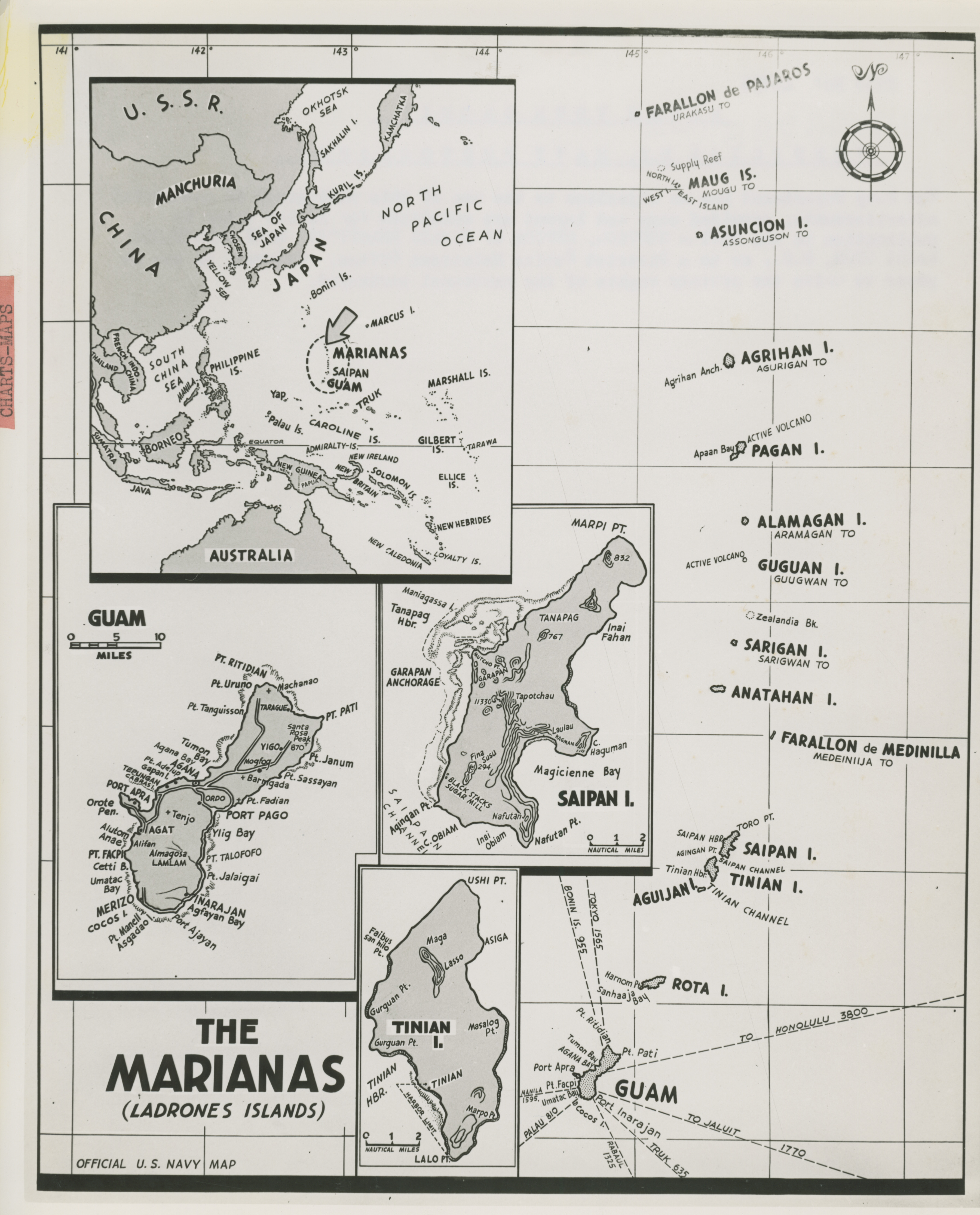
Official U. S. Navy Map of Western Pacific with larger scale inserts for the Marianas
U.S. Navy Official photograph, Gift of Charles Ives, from the Collection of The National World War II Museum
Description:
Official U. S. Navy Map of Western Pacific with larger scale inserts for the Marianas.'File No: 45735' No date.
Image Information
Donor:
Accession Number:
Date:
Hometown:
Branch:
Theater of Service:
POW / KIA:
Topical Subjects:
Collection Level:
The Charles Ives Collection consists of 719 photographs from the Pacific Theater of WWII. Many of the photographs were taken between 1944 and 1945. Mr. Ives inherited the photographs from a friend from Marblehead, Massachusetts who served as an aviator in the Army Air Corps and discharged as a Major in 1945.
Geography:
Mariana Islands
Thesaurus for Graphic Materials:
Maps--Mariana Islands
Diagrams